Utility Mapping in 30 seconds
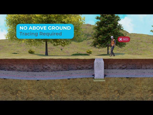
Gyroscopic utility mapping is a technique used within the utility pipeline construction and survey sectors to provide 3D geographical information of underground utility pipes and ducts.
As an autonomous Orientation Measurement Unit (OMU) is passed through a pipe or duct, a range of inertial sensors capture its change in heading, inclination, and acceleration at high frequency.
The resulting 3D profile is linked to the start- and endpoint coordinates of the pipe segment and an as-built map is created which can be immediately uploaded into any GIS-platform.
https://reduct.net/en/
Тэги:
#Reduct #Ductrunner #Pipeline_Mapping #Utility_mapping #Utility_detection #pipe_mapping #pipe_locating #XYZ #XYZ_mapping #Infotec #Pipe_Tracker #PipeTracker #AMP #Cues #Accurate_Mapping_Probe #SmartProbe #Smart_probe #Geospatial #Pipe_Surveying #Duct_Surveying #GyroTrack #Gyro_Track #Prime_HorizontalКомментарии:
Utility Mapping in 30 seconds
Reduct - Pipeline mapping systems
[MATLAB 기본 강좌] MATLAB에서 객체 클래스를 생성하고 활용하는 방법
MATLAB Korea
피특정후견인 제한능력자 완벽 정리 / 조문으로 보는 용어정리 민법총칙
위패스 김묘엽 민법
Texas811 Call before you dig
CPS Energy
참 나를 찾아 떠나는 내면의 여행 (2) ( 형산 송정현 교무 / 105년 11월 22일 / 12회 )
원불교 Won Buddhism


![[MATLAB 기본 강좌] MATLAB에서 객체 클래스를 생성하고 활용하는 방법 [MATLAB 기본 강좌] MATLAB에서 객체 클래스를 생성하고 활용하는 방법](https://hdtube.cc/img/upload/TWx3LVBzUFZoUDE.jpg)


